Asume uuel aadressil Meistri tn. 10, Tallinn. Oleme avatud E-R 8.00 – 17.00.
Uncategorised
Kvaliteedijuhtimissüsteemi korraline välisaudit
- 04.09.2016 toimus ettevõttes kvaliteedijuhtimissüsteemi korraline välisaudit, mille viis läbi Lloyd’s Register Quality Assurance audiitor Riina Soosalu. Audit läks suurepäraselt kuna mittevastavusi (NC) ei leitud.
Välisauditi tulemused tõestasid, et ettevõtte kvaliteedisüsteem toimib jätkuvalt efektiivselt ja vastab ISO 9001:2008 standardi nõuetele.
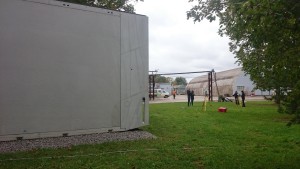
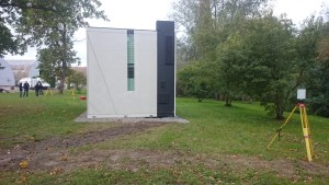
3-D scanning of a concrete composite modular house as part of the BIM cave research project at the Tallinn University of Applied Sciences
Geo S.T. OÜ made its contribution to surveys for the modular house completed as part of the BIM cave research project at the Tallinn University of Applied Sciences.
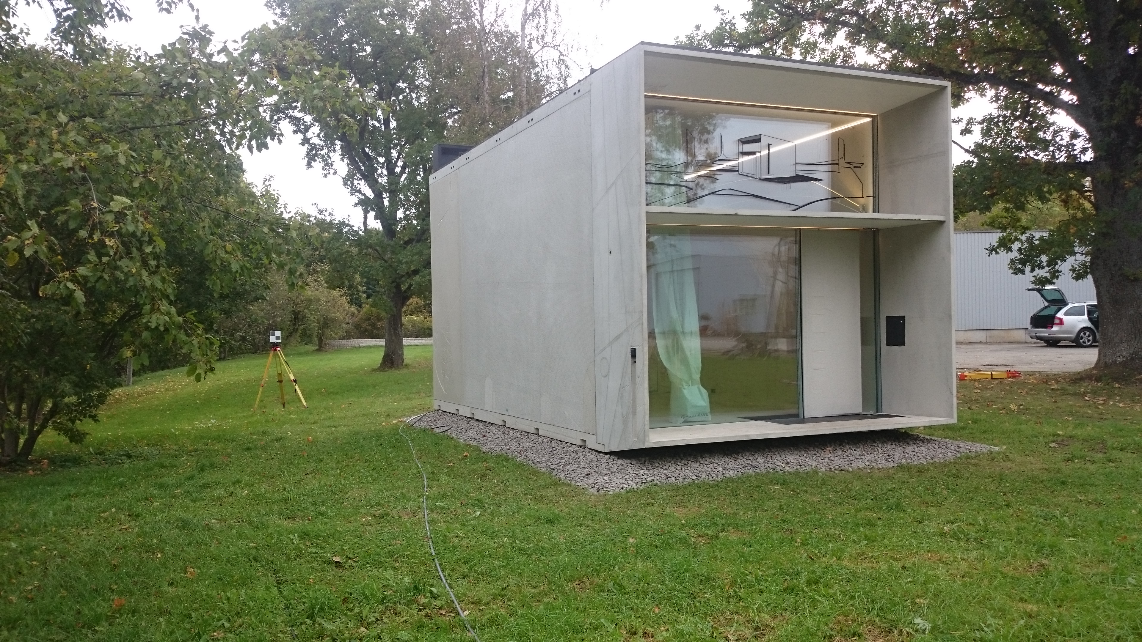
The concrete composite modular house built by Kodasema OÜ is a 2-storey residential building measuring approximately 3×7 m.
The purpose of the 3-D scanning of the modular house was:
- to create a practical model of the building by scanning it and compare this to the existing BIM design model
- to create a practical model of the building using tacheometer measurement and compare this to the practical model created based on the scan.
The results of the project will later be covered in the TTK University of Applied Sciences Construction Geodesy thesis works.
Tallinna Tehnikakõrgkooli BIM Koopa uurimisprojekti raames betoon-komposiit moodulmaja 3D skaneerimine
Geo S.T. OÜ andis oma panuse Tallinna Tehnikakõrgkooli BIM Koopa uurimisprojekti raames valminud moodulmaja mõõdistusel.
Kodasema OÜ poolt ehitatud betoon-komposiit moodulmaja on ca 3×7 m suurune betoonist 2.krs eluhoone.
Moodulmaja 3D skaneerimise eesmärgiks oli:
- luua skaneerimisega hoone praktiline mudel ja võrrelda seda olemasoleva BIM projektmudeliga
- luua tahhümeetrilise mõõdistusega hoone praktiline mudel ja võrrelda seda skaneeringu põhjal loodud praktilise mudeliga
Valminud töö tulemusi kajastatakse hilisemates Tallinna Tehnikakõrgkooli Rakendusgeodeesia valdkonna lõputöödes. (veel …)
Geo S.T. OÜ’s surveyors on the international OFFSHORE project MOHO-NORD
Since May 2015, Geo S.T. OÜ has been involved in the production of oil rig components. The title of the project is MOHO-NORD and the end client for the work is the fuel producer TOTAL of France. This is Geo S.T.’s first so-called OFFSHORE project. The oil rig will be erected in the seas off the coast of the Democratic Republic of the Congo in Africa. The content of the work is 3-D control during the entire production and installation process. The works are being carried out at Mäntyluoto, Republic of Finland, in a metal element production factory belonging to Technip Finland
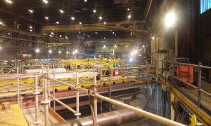
As the deadline of the project is short and the nature of the work complicated, geodesists work in two shifts.
By today already 3 Geo S.T. geodesists are involved in the project.
Of geodetic instruments, Leica Industrial series tachymeters (TDA5000, TDA5005 and TDRA 6000) and accurate industrial indication kits are being used. The software used is Leica Axys and Spatial Analyzer.
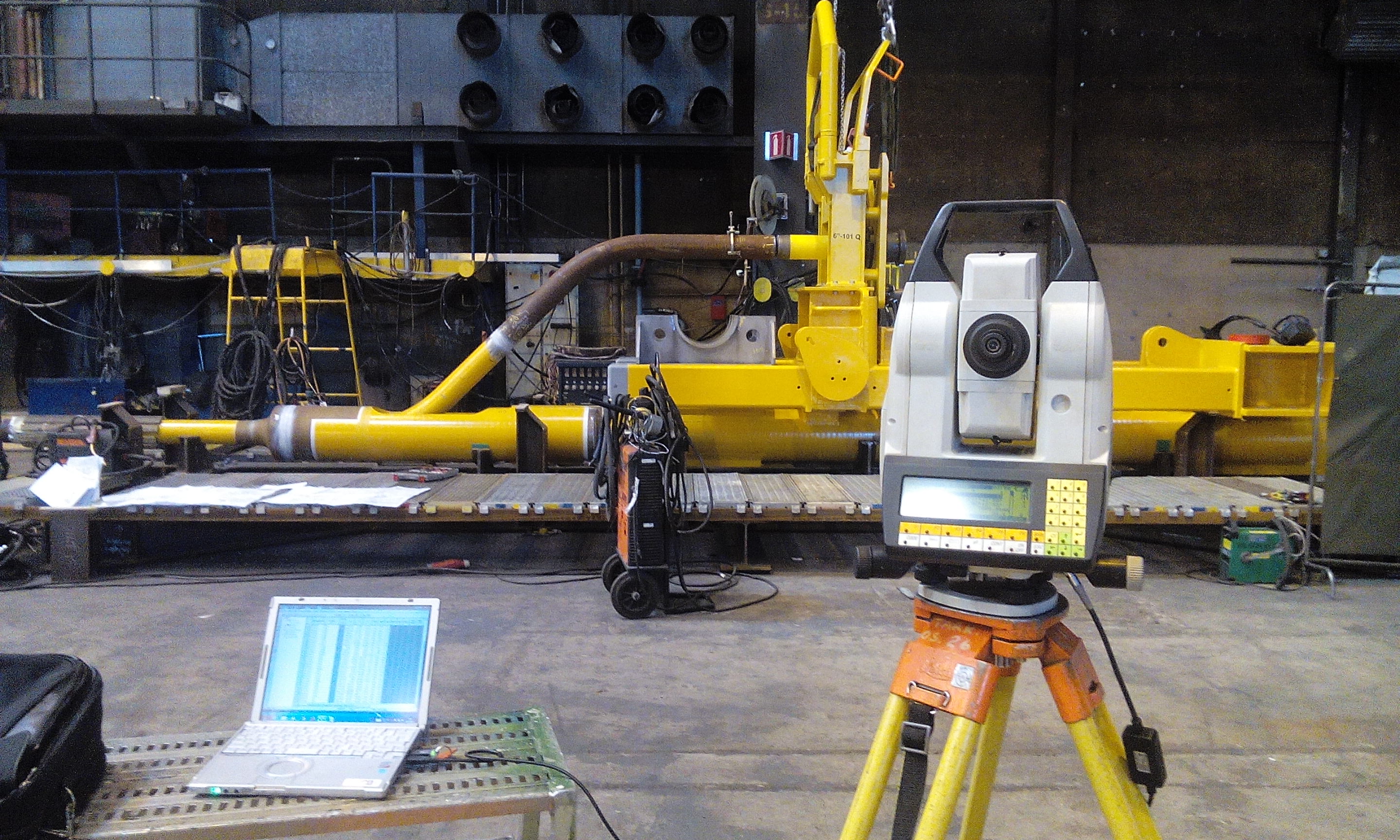
This project should be completed within this year. At the same time two new projects have started in parallel with the ongoing project and the work should also continue next year.
Geo S.T. OÜ geodeedid rahvusvahelises OFFSHORE projektis “MOHO-NORD”
Alates 05.2015 osaleb Geo S.T. OÜ naftaplatvormi komponentide tootmisprotsessis.
Projekti nimeks on “MOHO-NORD ” ja töö lõpptellijaks Prantsusmaa kütusetootja TOTAL. Tegemist on Geo S.T. esimese nn. OFFSHORE projektiga.
Nafta platvorm paigaldatakse Aafrikasse, Kongo Demokraatliku Vabariigi ranniku vetesse.
Tööde sisuks on elementide 3 dimensionaalne kontroll kogu tootmis- ja paigaldusprotsessi käigus.
Töid teostatakse Soome Vabariigis, Mäntyluotos, Technip Finlandile kuuluvas metallelementide tootmistehases.
Kuna töö tähtaeg on lühike ja töö iseloom keeruline, töötavad geodeedid kahes vahetuses.
Tänaseks on projektiga seotud juba 3 Geo S.T. geodeeti.
Geodeetilistest instrumentidest on kasutusel Leica Industrial seeria tahhümeetrid (TDA5000, TDA5005 ja TDRA 6000), ja täpsed tööstustähiste komplektid. Tarkvaradest on kasutusel Leica Axys ja Spatial Analyzer.
Projekti valmimine peaks jääma selle aasta sisse. Samas on paralleelselt alustatud ka kahe uue projektiga ning tööd peaksid jätkuma ka uuel aastal. (veel …)
Summer Seminar, Association of Estonian Surveyors
The Association of Estonian Surveyors invites its members, colleagues and friends to attend the Summer Seminar of the Association of Estonian Surveyors at Barto Guest House from 4 to 5 September 2015.

For further information visit:
http://egu.ee/konverentsid/suvepaevad või https://www.facebook.com/egu.ee?fref=nf
Source: Association of Estonian Surveyors
Eesti Geodeetide Ühingu Suveseminar
Eesti Geodeetide Ühing kutsub oma liikmeid, kolleege ja sõpru
Eesti Geodeetide Ühingu Suveseminarile 4 – 5. septembril 2015 Lääne-Virumaale, Barto Puhkemajja.
Täpsem info:
http://egu.ee/konverentsid/suvepaevad või https://www.facebook.com/egu.ee?fref=nf
Allikas:Eesti Geodeetide Ühing (veel …)